Download High-Quality Draft Plan Maps Here (PDF)
ActiveSGV
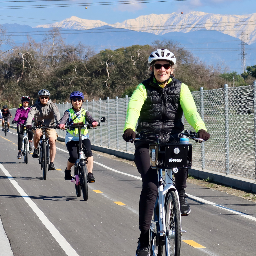
From July 2017 to April 2018, the development of a regional greenway feasibility study and a 5-city regional active transportation plan has been underway in the San Gabriel Valley. Slated for completion in Fall 2018, the project (www.ActiveSGV.org) is now entering its draft recommendations phase, providing an additional opportunity for the public to weigh in.
The below draft maps and spot recommendations have been informed by the input received from 748 community survey respondents, 11 input booths at public events (at least 2 per community), five community street audits, and two greenway exploratory audits, the #ActiveSGV project team has developed the following draft pedestrian and bicycle plans. Now is YOUR opportunity to review the drafts and provide additional suggestions, recommendations, and feedback.
Draft maps for the five project cities (Glendora, La Puente, Irwindale, Monrovia, and Montebello), as well as the SGV Greenways, can be found below; high-quality PDF versions of each can also be downloaded by clicking on the links above.
Please take a few minutes to view the maps and recommendations you're most interested in, and then submit this online form if you have any additional feedback. The input deadline is May 22, 2018.
Thank you in advance for your time and consideration!

SGV Greenway's prioritization started with a review of almost 900 miles of Waterway, Utility, Rail, and old Red Car Line alignments. This was reduced to about 220 miles by removing highly constrained corridors and existing segments and then further reduced to 72 miles by focusing on projects that have undergone previous planning.
Analysis methodology generally followed the CA-Active Transportation Program (ATP) scoring:
- Disadvantaged community is determined by Cal Enviro Screen, Median Household Income, and % of students eligible for free/reduced lunch.
- Need is determined by parks need (the county conducted a study in 2016), transit adjacency, destinations, population density, households without access to a car, gaps in the existing bike network, and connections to the existing bike network.
- Safety is measured by collisions and school adjacency.
- Public participation is measured by previous planning efforts and dedicated outreach.
- Other factors are constructability, cost, and land ownership.
Waterways
Alhambra Wash: 4.2 Miles
Cities: Industry (0.5 miles), El Monte (2 miles), San Gabriel (1.5 Miles)
The northern end of this corridor is Mission Rd, between San Gabriel High School and Alhambra Golf Course, where a potential connection exists to a proposed greenway along the rail corridor. Moving southward, the corridor passes Vincent Lugo Park, then uses an on-street connection across Valley Blvd, then continues along the channel past Del Mar Blvd. The southern end is at the Whittier Narrows Golf Course and Rio Hondo Bike Path. Several undercrossings, including I-10, and a narrow channel make this route challenging.
Arcadia Wash: 2.5 Miles
Cities: Arcadia (1.3 Miles), El Monte (0.2 Miles), Temple City (0.9 Miles)
This corridor begins near Arcadia High School on the north, then heads south to cross existing bike lanes on El Monte Ave. From there, it runs parallel to El Monte Ave until its terminus at the Rio Hondo Bike Path.
Bassett Channel: 1.3 Miles
Cities: City of Industry (0.3 Miles), Unincorporated (1 Mile)
From east to west, the corridor follows Workman Mill Rd near Valley Blvd to the San Gabriel River Trail. It must cross I-605 to make the connection to the San Gabriel River on the west, which would require a major undercrossing. The corridor would otherwise end at Packam Dr. Bike lanes on Workman Mill Rd provide an alternate connection via San Jose Creek.
Big Dalton Wash: 4 Miles
Cities: Baldwin Park (1.9 Miles), Covina (0.4 Miles), Irwindale (0.7 Miles), Unincorporated (0.9 Miles), West Covina (0.3 Miles)
This corridor fills in missing gaps in Big Dalton Wash, adding onto previously-funded portions in Glendora, Azusa, and Unincorporated areas. It begins at Barranca Ave at the northeast and travels southwest to the I-10, where it meets Walnut Creek. The portion of Walnut Creek from this confluence to the San Gabriel River has been previously funded.
Buena Vista Channel: 1.8 Miles
Cities: Irwindale (1.8 Miles)
This corridor begins on the east at the new trail connecting the San Gabriel River path and Duarte Gold Line Station. It follows the channel west to Sawpit Wash.
Charter Oak Wash: 1.5 Miles
Cities: Covina (1.5 Miles)
While this corridor is entirely within the City of Covina, it is in two main segments. At the north, it connects from E Cypress St to an existing path in Kahler Russell Park. An on-street connection south on Grand Ave then west on E Badillo St, rejoining the channel and traveling south through residential neighborhoods, crossing E Puente St and E Rowland St to reach E Workman Ave.
Eaton Wash: 4.6 Miles
Cities: Pasadena (2.1 Miles), Temple City (0.6 Miles), Unincorporated (1.8 Miles)
Filling out the northern reach of Eaton Wash, this corridor begins at E Washington Blvd and Woodlyn Rd at the north, running parallel to the utility corridor, south past I-210, where an on-street connection may be needed. The southern terminus is Muscatel Ave, where another planned segment is underway.
Little Dalton Wash: 3.3 Miles
Cities: Azusa (2 Miles), Unincorporated (1.2 Miles)
Beginning at the city limits of Glendora at the north, at Citrus College, Little Dalton Wash moves southwest through Azusa and Unincorporated areas. It passes just north of Azusa High School before intersecting I-210, where the channel will either need to be modified for an undercrossing or an on-street connection will need to be used. The corridor passes three more schools before terminating at the confluence with Big Dalton Wash. Portions within Glendora have already received funding and are excluded from this study.
Puente Creek: 2.2 Miles
Cities: City of Industry (0.7 Miles), La Puente (0.8 Miles), Unincorporated (0.7 Miles)
This corridor begins just west of the shopping center at S Hacienda Blvd and Amar Rd in La Puente. Moving southwest, it passes Sparks Middle and Elementary Schools and crosses a set of railroad tracks between Proctor Rd and Don Julian Rd before meeting San Jose Creek.
Rubio Wash: 4.7 Miles
Cities: El Monte (0.1 Miles), Rosemead (2.0 Miles), San Gabriel (1.7 Miles), San Marino (0.7 Miles), South El Monte (0.1 Miles), Unincorporated (0.2 Miles)
This corridor begins at San Marino High School in the north, and, moving south, crosses Huntington Blvd and San Gabriel Country Club. Portions of the channel are blocked with parking lots near Valley Blvd and S Walnut Grove Ave. The channel crosses under I-10 before meeting the west bank of the Rio Hondo.
San Dimas Wash: 2.7 Miles
Cities: Covina (2.1 Miles), Glendora (0.3 Miles), Unincorporated (0.3 Miles)
Closing a gap between a funded portion in Glendora and its confluence with Big Dalton Wash, this corridor follows an existing maintenance road and connects to Hollenbeck Park.
San Jose Creek: 16.8 Miles
Cities: City of Industry (9.5 Miles), Pomona (5.1 Miles), Unincorporated (2.2 Miles)
The longest overall corridor in this study, San Jose Creek, largely parallels SR 60 and Metrolink rail. The northeasternmost point connects to Ganesha Park in Pomona and would require a new underpass or an on-street connection to move south of I-10. The corridor passes several parks and schools before crossing under SR 71 and SR 57, running alongside Cal Poly Pomona before entering the City of Industry. A portion at the western end, within the City of Industry, has received funding, and an unincorporated segment at the furthest west point connects to the San Gabriel River.
San Jose Creek – South Fork: 2.6 Miles
Cities: Pomona (2.6 Miles)
This corridor runs from the Veterans Park soccer complex in Pomona southwest to baseball fields in Diamond Bar, crossing industrial and agricultural areas.
Santa Anita Wash: 3.2 Miles
Cities: Arcadia (2 Miles), Monrovia (0.8 Miles), Unincorporated (0.4 Miles)
Beginning at E Sycamore Ave at the north, near Foothills Middle School, the corridor passes Eisenhower Park before crossing under I-210. Heading south, it crosses relatively few streets before reaching the Rio Hondo Bike Path in Arcadia at E Live Oak Ave.
Sawpit Wash: 2.2 Miles
Cities: Irwindale (0.8 Miles), Monrovia (0.4 Miles), Unincorporated (0.9 Miles)
This corridor begins in the north at E Duarte Rd near Maxwell Elementary School. It follows the channel south, joining with Buena Vista Channel, terminating at Peck Rd. A connection from the end of Sawpit Wash to the Rio Hondo Bike Path would be made at Peck Rd Park.
Thompson Creek: 3 Miles
Cities: Claremont (0.6 Miles), Pomona (2.4 Miles)
Near Sumner Elementary School in Claremont, the corridor follows existing maintenance roads adjacent to the channel south to Bonita Ave, where it runs parallel to Fulton Rd until reaching the Pomona Fairplex. The southern terminus of the channel can connect to San Jose Creek at Ganesha Park.
Walnut Creek: 5.2 Miles
Cities: Covina (1.2 Miles), Unincorporated (0.4 Miles), West Covina (3.6 Miles)
This corridor’s easternmost point, on N Reeder Ave, south of Badillo Elementary School in Covina, follows a naturalized creek through a neighborhood with limited access. An alternative easternmost point would be at E Covina Hills Rd, where an existing maintenance road follows the channel to I-10, where an undercrossing or on-street connection would be needed. South of I-10, the corridor follows the channel west to meet a previously funded project in Baldwin Park at Big Dalton Wash.
Rail Corridors
Alhambra Subdivision (Amtrak Parallel): 4 Miles
Cities: City of Industry (0.5 Miles), El Monte (2 Miles), San Gabriel (1.5 Miles)
An east-west connection between the Rio Hondo and San Gabriel River Bike Paths is created by this rail corridor in the City of Industry and El Monte. Madrid Middle School lies at the eastern end. Overall, the right of way is sufficient to create a trail parallel to existing rail lines, though a crossing at Garvey Ave may require an on-street connection or a new bridge. The portion of the corridor in San Gabriel creates an east-west connection between Alhambra Wash and Rubio Wash, two other proposed greenways.
Utility Corridors
Edison Right of Way (ROW): Monterey Park, 0.7 Miles
Meeting the existing Edison Trails Mark in Monterey Park, this connection runs west then south, terminating at W Floral Dr between Hendricks Ave and Findlay Ave. This trail would require negotiations with existing nursery operations within the utility corridor.
Edison ROW: Rosemead, 3 Miles
This utility corridor spans nearly the entire San Gabriel Valley, north to south, and crosses several other potential greenways. The portion under study here, in Rosemead, begins at Grand Ave in the north, crosses I-10, and ends at Graves Ave. Nurseries are currently using portions of the corridor while other portions are open. Zapopan Park falls in the middle of the corridor.
Edison ROW: South Pasadena, 1.3 Miles
This corridor runs from Grevelia St and Garfield Park at the north to W Alhambra Rd and Alhambra Park at the south, with a gap in the middle at South Pasadena Middle School. It passes primarily through residential neighborhoods and is currently clear of existing uses beyond a maintenance road.

Glendora Spot Recommendations (based on community input and feedback)
- Convert to back-in angled parking
- Intersection improvements: Add high-visibility crosswalks and Curb Extensions to all four corners.
- Intersection improvements: Add Curb Extensions and/or Pedestrian Safety Island to mitigate long crossing distances.
- Intersection improvements: Add Curb Extensions. Add Leading Pedestrian Interval. Add High-visibility crosswalks. Bike Boxes/Loop detectors to facilitate bikeway crossing.
- Bicycle Loop Detectors
- Traffic calming
- Pedestrian lighting improvements
- Bike Parking: Bike Parking at Finkbiner Park
- Intersection improvements: Add protected left turn signal/phase to Gladstone St. Add Leading Pedestrian Interval. Add Bicycle loop detectors. Add High-visibility crosswalks. Add a crosswalk to the south leg of the crosswalk. Add Curb Extensions to mitigate sight line issues from high walls/shrubbery/trees.
- Intersection improvements: Add Rectangular Rapid Flashing Beacon to increase driver yield rates at unsignalized school crossing. Add Curb Extensions to tighten the curb radius for vehicles turning right onto Glenwood.
- Intersection improvements: Consider a crosswalk with a Rectangular Rapid Flashing Beacon to facilitate crossing for transit users.
- Intersection improvements: Consider a crosswalk with a Rectangular Rapid Flashing Beacon to facilitate crossing for transit users.
- Intersection improvements: Install protected left turns in all directions. Repaint crosswalks with high-visibility striping. Install Curb Extensions and Leading Pedestrian Interval signal phases.
- Intersection improvements: Add Curb Extensions where feasible. Add high-visibility crosswalks. Add protected left turn phases/signals.
- Intersection improvements: Add Curb Extensions to tighten turn radii and increase visibility. Add high-visibility crosswalks. Add Leading Pedestrian Interval signal phases.
- Underpass improvements: Add lighting and better pedestrian facilities connecting to South Hills Park trailhead
- Underpass improvements: Add lighting and better pedestrian facilities connecting to South Hills Park trailhead
- Underpass improvements: Add lighting and better pedestrian facilities
- Underpass improvements: Improve Lighting and pedestrian environment generally
- Intersection improvements: Major improvements needed for pedestrian safety. Stripe crosswalks to the island. Add a Rectangular Rapid Flashing Beacon.
- Intersection improvements: Gold Line intersecting with these two streets at an angle presents a challenge for cyclists and peds. Fill RR tracks in with rubber or similar to prevent bike wheels from getting caught. Add Curb Extensions to tighten the turn radius.

Irwindale Spot Recommendations (based on community input and feedback)
- Site of fatal collision: Complex and wide intersection with railroad crossing. Improvements could include lighting, bulb-outs, high visibility crosswalks, and Pedestrian Safety Island.
- Offset intersection: Long crossings. Textured crosswalks could be made more visible. NW and NE corners have very wide turning radii.
- New crossing: Add a mid-block crosswalk.
- Intersection improvements: Add high-visibility crosswalks and Curb Extensions. Consider Pedestrian Safety Island.
- New crossing: Potential crosswalk to bus stop.
- Intersection improvements: Add high-visibility crosswalks. Evaluate for Pedestrian Safety Islands. Open 3rd crossing on the west leg of the intersection.
- Improve access: The entrance gate is narrow and sometimes closed.
- Improve intersection: Slip lane, offset intersection, and lack of crosswalk creates dangerous conditions for walking. Consider closing slip lane, tightening right turn movement, and painting a high-visibility crosswalk.
- Intersection Improvements: Crosswalks faded, repaint high visibility. Open all four legs of the crosswalk.

La Puente Spot Recommendations (based on community input and feedback)
- Intersection improvements: Repaint crosswalks with High Visibility. Open the third leg of the crossing. Shorten crossing distances with Curb Extensions.
- Intersection improvements: Add High Visibility Crosswalks. Add a Leading Pedestrian Interval signal. Add protected left turn signals/phases.
- Intersection improvements: Add High Visibility Crosswalks. Add a Leading Pedestrian Interval signal. Consider raising the bus pad to prevent delays and shorten crossing distances.
- Intersection improvements: Add High Visibility Crosswalks.
- Intersection improvements: Add Pedestrian Safety Island if feasible
- Intersection improvements:
- Intersection improvements: Add High Visibility Crosswalks. Add a Leading Pedestrian Interval signal. Add protected left turn signals/phases. Add Pedestrian Safety Island if feasible.
- Intersection improvements: Add High Visibility Crosswalks. Add Pedestrian Safety Island if feasible.
- Intersection improvements: Add High Visibility Crosswalks. Add Pedestrian Safety Island to the west crosswalk leg. Open the east leg of the crossing if feasible.
- Intersection improvements: 2000 ft between crossings on this stretch with multiple injury collisions. Consider mid-block crossing with Pedestrian Safety Island.
- Intersection improvements: Add High Visibility crosswalks. Add a Leading Pedestrian Interval signal. Add curb extensions.
- Intersection improvements: Add High Visibility crosswalks. Add a Leading Pedestrian Interval signal. Add Curb Extensions to increase visibility.
- Intersection improvements: Add High Visibility crosswalks. If feasible, close slip lanes. Complex intersection.
- Intersection improvements: Add High Visibility crosswalks.
- Intersection improvements: Add High Visibility crosswalks.
- Intersection improvements: Add High Visibility crosswalks. NE and SW corners have a feeder lane that closes shortly after the intersection. If feasible, close feeder lanes and construct Curb Extensions to shorten crossing distances.
- Intersection improvements: Add Curb Extensions on Unruh Ave to shorten crossing distances. Consider protected left turn phasing.
- Intersection improvements: Add High Visibility Crosswalks. Add Curb Extensions on N California Ave to shorten crossing distances. Add a Leading Pedestrian Interval signal.
- Intersection improvements: Open the third leg of the crosswalk.
- Install missing sidewalk
- Intersection improvements: Add yellow high-visibility crosswalks. Add a Leading Pedestrian Interval signal. Add protected left turn phases.
- Intersection improvements: Add high-visibility yellow crosswalks.
- Intersection improvements: Repaint crosswalks with yellow High Visibility Crosswalks. Add a Leading Pedestrian Interval signal.
- Install missing sidewalks
- Intersection improvements: Add High Visibility crosswalks. Add a Leading Pedestrian Interval signal.

Monrovia Spot Recommendations (based on community input and feedback)
- Intersection improvements: Add High Visibility Crosswalks to all four legs of the intersection. Consider protected left-turning phases. Add Curb Extensions. Consider moving 254 bus stop to the far side of the intersection to improve safety and headways
- Intersection improvements: Add High Visibility Crosswalks. Add Curb Extensions.
- Intersection improvements: Add High Visibility Crosswalks. Open the 4th leg of the intersection with the crosswalk. Consider lengthening the pedestrian crossing phase.
- Add crossing: Consider additional crossing at Encino Ave (or the most feasible intersection) with Pedestrian Safety Island and Rectangular Rapid Flashing Beacon.
- Intersection improvements: Investigate protected left turns from Duarte. Narrow roadway to reduce turn radius. Open third leg of crossing. Consider driveway consolidation.
- Intersection improvements: Repaint crossings with High-Visibility crosswalks. Add protected left turn phases. Tighten the curb radius on the SW intersection.
- Intersection improvements: Add traffic calming measures and facilitate crossing. The nearest crosswalk is at Huntington to the South and E Lime to the North.
- Intersection improvements: Add High Visibility Crosswalks (Yellow). Add bicycle loop detectors
- Intersection improvements: Add bollards to unused space in the North of the intersection to function as Pedestrian Safety Island and tighten turning movements.
-Install High Visibility crosswalks on all legs - Intersection improvements: Add Crosswalks and Curb Extensions to all legs.
- Underpass improvements: Add lighting. Consider murals.
- Intersection improvements: Consider new stop signs/crosswalks across Primrose. Add High Visibility crosswalks across Maple
- Intersection improvements: Repaint High Visibility crosswalks.
- Intersection improvements: One side of the intersection has been improved. Continue improvements to the adjacent side of the intersection. Add High Visibility crosswalks across Primrose.
- Intersection improvements: Add stop signs and crosswalks across Alta Vista or other traffic calming treatments. Adding a stop sign/traffic calming treatment would facilitate the Bike Route on Chestnut Ave.
- Intersection improvements: Add High Visibility Crosswalks.
- Underpass improvements: Add lighting. Consider murals.
- Underpass improvements: Add lighting. Consider murals.
- Underpass improvements: Add lighting. Consider murals.
- Underpass improvements: Add lighting. Consider murals.
- Underpass improvements: Add lighting. Consider murals.
- Underpass improvements: Add lighting. Consider murals.
- Intersection improvements: Foothill is clearly a High Injury Corridor. The proposed class IV protected bikeway could calm traffic and reduce collisions, however, intersection improvements along the corridor should be studied as well.

Montebello Spot Recommendations (based on community input and feedback)
- Intersection improvements: Improve Crossings at 18th St and N Vail Ave.
- Driveway consolidation: 3 injury collisions.
- Improve access: Create an access point to the Rio Hondo path.
- Improve access: Create an access point to the Rio Hondo path.
- Feasibility study: Study the feasibility of a linear Park/Path under power lines.
- Intersection improvements: Hard to navigate the intersection. Suggestions pending.
- Intersection improvements: Expanded improvements to existing project on Montebello Ave
- Improve access: Connect Madison Ave to River Path. At the moment, the only nearby access is via a major arterial, Beverly Blvd.
- Rio Hondo Bike Path: Only partially in Montebello jurisdiction; many public comments regarding safety concerns, need to improve lighting, add call boxes, create more access points, and improve security.
- Missing sidewalks near Metrolink station: Repair/construct sidewalk
- Intersection improvements: Add pedestrian improvements, including Curb Extensions and a Rectangular Rapid Flashing Beacon at the unsignalized crossing on Garfield and Repetto, adjacent to Sacred Heart High School.
- Intersection Improvement Policy: Most high-speed arterials lack high-visibility crosswalks. Intersections adjacent to schools may also want to consider Leading Pedestrian Intervals.